2015, EGS, Lincs, LS16 Jack-Up Clearance Survey

2015, EGS, Lincs, LS16 Jack-Up Clearance Survey

Powered by: TCE
Don't show this

What is a series page?

Download MEDIN file

Last series update:

May 2021

Collection date:

November 2015 - December 2015

The collection date represents the period of data collection or study duration. For example: '16/04/2015-05/05/2015'

Publication date:

May 2021

The publication date is the date the series was published on the Marine Data Exchange. For example: '23/04/2017'

Published by:

The Crown Estate

Summary

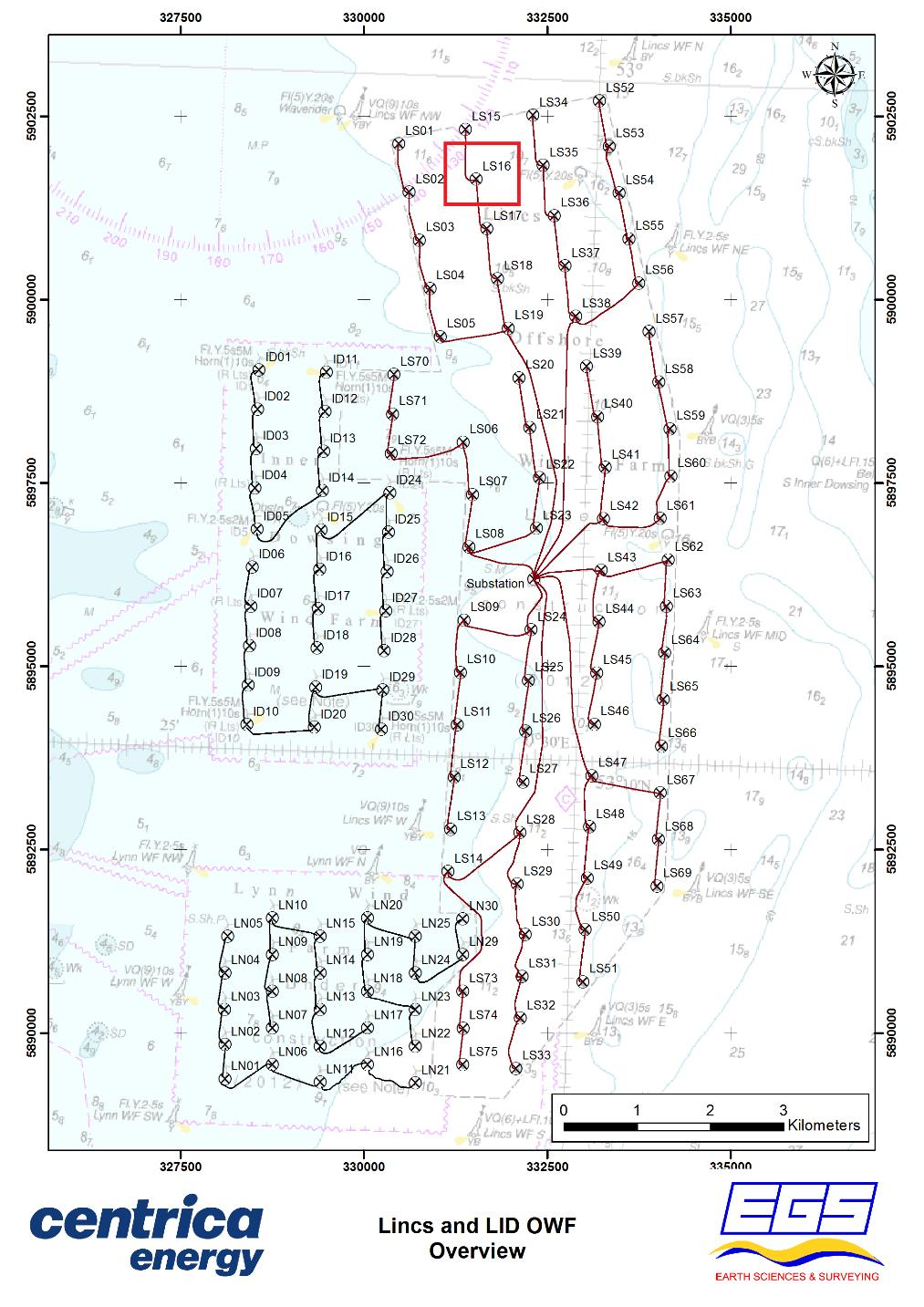
EGS International Ltd (EGSi) were contracted by Centrica Renewable Energy Limited (CREL) to
undertake the 2015 post construction hydrographic and geophysical surveys of the Lincs and
L&ID (Lynn and Inner Dowsing) windfarm array cable routes.
The Lincs and L&ID windfarms are located in the southern North Sea, approximately 5km off
the coast ...

Categories:
Geophysical
Categories indicate the area of study or data type the series is associated with. For example, a survey carrying out grab sampling would have the category 'Benthic Ecology', while a desktop study exploring the impact of substation design on bird nesting would have the categories ' Birds, Engineering Design'
Available in this series:
Data Highlights
1
Datasets
2
Reports
2

Data Highlights


Explore the wealth of the data gathered in the 2015, EGS, Lincs, LS16 Jack-Up Clearance Survey


4

A 2015 Turbine LS16 Clearance Survey at the Lincs Offshore Wind Farm