
2014-2015, Mainstream Renewable Power, Neart na Gaoithe Offshore Wind Farm, FLiDAR data
Summary
Data & downloads
Datasets
Related Pages
 Series
2015, Fugro, EMU Limited, Neart na Gaoithe Offshore Wind Farm, Geophysical Survey
Mainstream Renewable Power Limited is currently developing the Neart na Gaoithe Offshore Wind Farm, located 15.5 km off Fife Ness on the east coast of Scotland. An Environmental Statement had to be prepared in support of the application for planning permission to construct and operate grid connection infrastructure associated with the Neart na Gaoithe Offshore Wind Farm located within East Lothian. Fugro EMU Limited was commissioned by Neart na Gaoithe Offshore Wind Ltd to undertake a hydrographic and geophysical survey on the Neart na Gaoithe wind farm, off the east coast of Scotland. Multibeam bathymetry and sidescan sonar data were acquired over 64 wind turbine generator (WTG) positions, two offshore transformer modules positions and six backup WTG positions. For each position the survey covered a minimum 400 m by 400 m area.
 Series
2014-2015, Neart na Gaoithe Offshore Wind Farm, Fife Ness Onshore LiDAR
For the Neart na Gaoithe offshore wind farm project, two onshore ZEPHIR lidars were used: Fife Ness and Isle of May. This series contains the data and information relating to the Fife Ness onshore lidar.
2014, Whiteford Geoservices Ltd, Neart na Gaoithe Offshore Wind Farm, Onshore East Coast Main Line Geotechnical Survey
Mainstream Renewable Power Limited is currently developing the Neart na Gaoithe Offshore Wind Farm, located 15.5 km off Fife Ness on the east coast of Scotland. Whiteford Geoservices Ltd were commissioned by Mainstream Renewable Power Limited, on behalf of Neart na Gaoithe Offshore Wind Limited, to undertake a geotechnical investigation at Thortonloch, East Lothian. Two (2) no. subsea transmission cables carrying electricity from the Neart na Gaoithe offshore site will reach landfall at Thortonloch beach, approximately 10km southeast of Dunbar, Scotland. From this point to the proposed grid connection point at Crystal Rig wind farm, 2 no. onshore underground transmission cables (installed in the same trench) will be constructed of approximately 12.3km in length. As part of the development process and in order to inform the detailed design of the transmission cable, a geotechnical and topographical survey was undertaken at the East Coast main Line railway crossing along the Neart na Gaoithe onshore cable route. These survey works were carried out within the onshore development boundary of the Neart na Gaoithe project, adjacent to the ECML railway line.
 Series
2013-2014, Fugro Alluvial Offshore Ltd., Neart na Gaoithe Offshore Wind Farm, Geotechnical Survey
Mainstream Renewable Power Limited (Mainstream) is currently developing the Neart Na Gaoithe (NNG) offshore wind farm site and export cable corridor in Blocks 25/19, 25/24, 25/25 and 33/4 of the UK sector, North Sea. Fugro Alluvial Offshore Limited (FAOL) was contracted by Fugro Geoconsulting Limited (FGCLTD) on behalf of Mainstream Renewable Power Limited (Mainstream) to perform a geotechnical site investigation at the NNG site to provide soils information to assist in the development of the proposed export cable route and main array.
Series2013-2015, Neart na Gaoithe Offshore Wind Farm, Isle of May Onshore LiDAR
For the Neart na Gaoithe offshore wind farm project, two onshore ZEPHIR lidars were used: Fife Ness and Isle of May. This series contains the data and information relating to the Isle of May onshore lidar.
2013, Whiteford Geoservices Ltd, Neart na Gaoithe Offshore Wind Farm Intertidal Geotechnical, Geophysical and Topographic Survey
Whiteford Geoservices Ltd were commissioned by Mainstream Renewable Power Limited, on behalf of Neart na Gaoithe Offshore Wind Limited, to undertake a geotechnical, geophysical and topographic investigations at Thortonloch, East Lothian. Two (2) no. subsea transmission cables carrying electricity from the NNG offshore site will reach landfall at Thortonloch beach, approximately 10km southeast of Dunbar, Scotland. From this point to the proposed grid connection point at Crystal Rig wind farm, 2 no. onshore underground transmission cables (installed in the same trench) will be constructed of approximately 12.3km in length. The majority of the required investigation took place in a zone affected by tidal variation in level and waterline extents. These survey works were carried out in intermittently submerged areas subject to tidal variation, generally landward of the line of Lowest Astronomical Tide (LAT). Additional geophysical survey works were also conducted within fields south of the A1, where the proposed transmission cables cross HV cables exiting Torness Power Station and the east coast mainline railway.
 Series
2012, LUC, ARUP, Neart na Gaoithe Offshore Wind Farm, Onshore Geotechnical and Geo-environmental Desk Study
Mainstream Renewable Power Limited is currently developing the Neart na Gaoithe Offshore Wind Farm, located 15.5 km off Fife Ness on the east coast of Scotland. An Environmental Statement had to be prepared in support of the application for planning permission to construct and operate grid connection infrastructure associated with the Neart na Gaoithe Offshore Wind Farm located within East Lothian. Land Use Consultants Limited (LUC) with associated sub-consultant Arup Partners Ltd (ARUP) were commissioned by Mainstream Renewable Power Limited, on behalf of Neart na Gaoithe Offshore Wind Limited, to undertake a Geotechnical and Geo-environmental Desk Study as part of the Environmental Statement. The desk study of the proposed route of the buried cable did not comprise opening up or testing of the ground, but a site walkover was carried out. The objectives of this desk study are to identify any potential geotechnical and geo-environmental risks / constraints associated with the development of the site, and provide recommendations for appropriate site investigations.
 Series
2012, Anatec Ltd, Neart na Gaoithe Offshore Wind Farm, Maritime Traffic Survey
Mainstream Renewable Power Limited is currently developing the Neart na Gaoithe Offshore Wind Farm, located 15.5 km off Fife Ness on the east coast of Scotland. Anatec Limited were commissioned to undertake a maritime traffic survey which was carried out in the Neart na Gaoithe site between 2nd August 2012 and 30th September 2012. Data was collected from vessels which were identified using AIS (Automatic Identification System) within 10 nm of the Neart na Gaoithe site during 14 full days August 2012 and 14 full days September 2012. The primary objective of the survey was to identify and validate the routeing of vessels and the level of vessel activity in and around the Neart na Gaoithe Offshore Wind Farm site. This was achieved by recording in real-time the positions of vessels within range of the Automatic Identification System (AIS) receiver.
 Series
2012, Fugro GeoConsulting Ltd., Neart na Gaoithe Offshore Wind Farm, Geotechnical Site Investigation
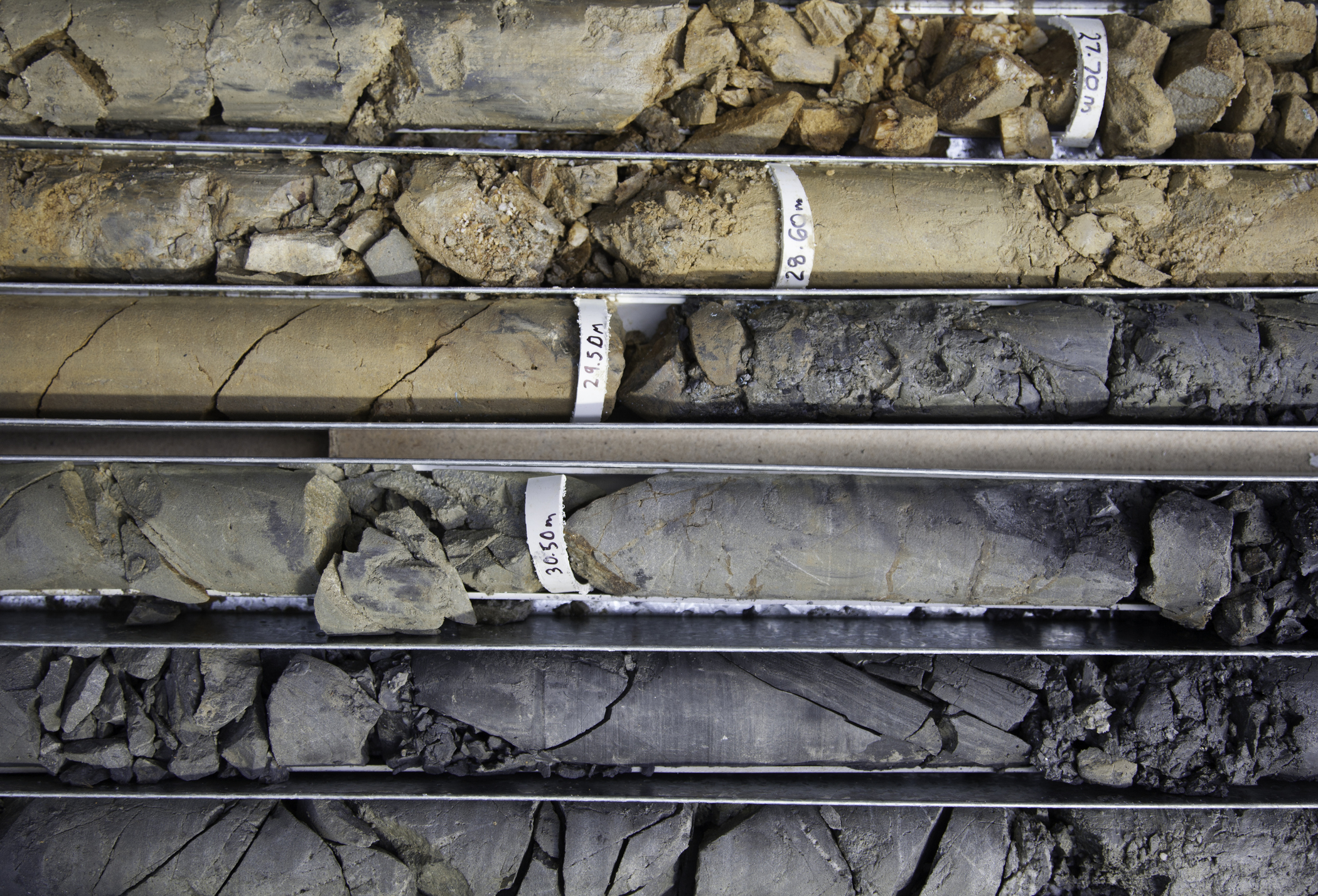
On behalf of Mainstream Renewable Power Limited , Fugro GeoConsulting Limited has carried out a geotechnical site investigation at Neart Na Gaoithe offshore wind farm site and export cable corridor in Blocks 25/24, 25/25, 25/29 and 33/4, of the UK sector, North Sea. The survey presents the results of the Cone Penetration Tests (CPTs) carried out at 32 locations in the site and 40 locations in the cable corridor. Further laboratory testing were done on the data gathered from 9 Boreholes and 40 Vibrocore locations in the site and cable corridor respectively. The geotechnical logs created provides soil information to assist in the development of the proposed main turbine (array) area and the subsea transmission cable route.
 Series
2012, LUC, Streetwise, Neart na Gaoithe Offshore Wind Farm, Onshore Baseline Traffic Survey
Mainstream Renewable Power Limited is currently developing the Neart na Gaoithe Offshore Wind Farm, located 15.5 km off Fife Ness on the east coast of Scotland. An Environmental Statement had to be prepared in support of the application for planning permission to construct and operate grid connection infrastructure associated with the Neart na Gaoithe Offshore Wind Farm located within East Lothian. Land Use Consultants Limited (LUC) with associated sub-consultant Streetwise were commissioned by Mainstream Renewable Power Limited, on behalf of Neart na Gaoithe Offshore Wind Limited, to undertake a traffic survey at Thorntonloch as part of the Environmental Statement. The purpose of the survey was to record the baseline traffic conditions in the vicinity of the proposed onshore construction site. The data was collected to understand the current traffic level, and to inform the assessment of changes which might occur during the construction phase.
2012, URS, Neart na Gaoithe Offshore Wind Farm, Onshore Peat Stability Assessment
Mainstream Renewable Power Limited is currently developing the Neart na Gaoithe Offshore Wind Farm, located 15.5 km off Fife Ness on the east coast of Scotland. An Environmental Statement had to be prepared in support of the application for planning permission to construct and operate grid connection infrastructure associated with the Neart na Gaoithe Offshore Wind Farm located within East Lothian. Land Use Consultants Limited (LUC) with associated sub-consultant URS Infrastructure & Environment UK Limited (URS) were commissioned by Mainstream Renewable Power Limited, on behalf of Neart na Gaoithe Offshore Wind Limited, to undertake a Peat Stability Assessment as part of the Environmental Statement. The purpose of the survey was to investigate peat stability in the vicinity of the proposed onshore construction site.
Series2011-2012, LUC, Border Geo-Science, Neart na Gaoithe Offshore Wind Farm, Onshore Geological and Groundwater Assessment
Mainstream Renewable Power Limited is currently developing the Neart na Gaoithe Offshore Wind Farm, located 15.5 km off Fife Ness on the east coast of Scotland. An Environmental Statement had to be prepared in support of the application for planning permission to construct and operate grid connection infrastructure associated with the Neart na Gaoithe Offshore Wind Farm located within East Lothian. Land Use Consultants Limited (LUC) with associated sub-consultant Border Geo-Science were commissioned by Mainstream Renewable Power Limited, on behalf of Neart na Gaoithe Offshore Wind Limited, to undertake a geological and groundwater assessment as part of the Environmental Statement.The purpose of the survey was to record the baseline geology in the vicinity of the proposed onshore construction site.