2013, EGS, Ormonde, Geophysical Survey

2013, EGS, Ormonde, Geophysical Survey

Powered by: TCE
Don't show this

What is a series page?

Download MEDIN file

Last series update:

March 2026

Collection date:

June 2013 - June 2013

The collection date represents the period of data collection or study duration. For example: '16/04/2015-05/05/2015'

Publication date:

August 2022

The publication date is the date the series was published on the Marine Data Exchange. For example: '23/04/2017'

Published by:

The Crown Estate

Summary

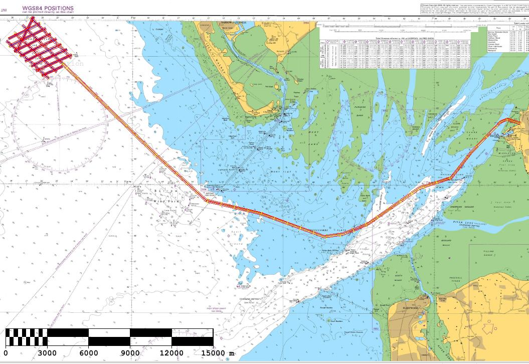
EGSi have been contracted to conduct a detailed bathymetric and geophysical survey of the Ormonde OWF and export cable route that can be compared with the data collected from previous surveys in order to meet the Marine Licence requirements. These require an assessment of the changes of both the bathymetry and the seabed morphology to be made at va...

Categories:
Geophysical
Categories indicate the area of study or data type the series is associated with. For example, a survey carrying out grab sampling would have the category 'Benthic Ecology', while a desktop study exploring the impact of substation design on bird nesting would have the categories ' Birds, Engineering Design'
Available in this series:
Data Highlights
1
Datasets
5
Reports
3

Data Highlights


Explore the wealth of the data gathered in the 2013, EGS, Ormonde, Geophysical Survey


4

Ormonde Offshore Wind Farm: Post-construction Geophysical Survey, 2013.