

2014-2016, DONG Energy, Westermost Rough, LiDAR Survey
Summary
Data & downloads
Datasets
Data Highlights
Related Pages
 Series
2019, Precision Marine Survey, Westermost Rough, Year 2 Benthic Survey
This report aims to provide an assessment of the benthic habitats and associated assemblages within and adjacent to the areas of potential impact resulting from the construction and of the WMR OWF. It also provides a comparison with previous data collected at the development site during pre‐construction surveys. This survey aims to fulfil conditions within the WMR OWF Marine Licence (L/2011/00305) as part of the project Environmental Monitoring Programme (EMP).
 Series
2017, Holderness Fishing Industry Group, Westermost Rough Offshore Wind Farm, Fish and Shellfish Monitoring Report
The Holderness Fishing Industry Group (HFIG) conducted a survey in 2017 investigating the short-term effects of the construction of the Westermost Rough offshore windfarm on the commercially important crustacean stocks in the area. This survey supports the research undertaken by HFIG in 2013 (baseline survey (Roach & Cohen, 2013)) and 2015 (first year post build of the wind farm (Roach & Cohen, 2015)), forming part of the continuing study of the effects of wind farm construction on commercial shellfish stocks.
 Series
2017, Spectrum Geosurvey, Westermost Rough, Consent Survey Q2 2017
Spectrum Geosurvey Limited was contracted to perform multibeam bathymetry surveys of selected assets on the Westermost Rough Offshore Wind Farm (WMR01). The purpose of the survey programme was to provide bathymetric data meeting the requirements of the wind farm’s Marine Licence L/2011/00305/10. The survey scope consisted of surveys along the export cable, around the offshore substation, around six turbines and along the array cables bounding the south, west and north sides of the main site. Multibeam bathymetry was acquired on board the Foryd Bay between the 20th April and 14th May 2017.
 Series
2016, Spectrum Geosurvey, Westermost Rough, Consent Survey Q2 2016
Spectrum Geosurvey Limited was contracted to perform multibeam bathymetry surveys of selected assets on the Westermost Rough Offshore Wind Farm (WMR01). The purpose of the survey programme was to provide bathymetric data meeting the requirements of the wind farm’s FEPA licence agreement. The survey scope consisted of surveys around six turbine foundations and along the sixteen array cable routes bounding the south, west and north sides of the main site. Multibeam bathymetry was acquired on board the Foryd Bay between 6th April and 12th April 2016.
 Series
2015, DONG Energy, Westermost Rough, Additional Electromagnetic Field Evidence
The document within this series provides additional evidence in relation to the burial depth of the array and export cables at the Westermost Rough Offshore Wind Farm, and the potential effects of a reduction in burial from the electromagnetic fields that are produced from them during operation. The report is a desk-based assessment the aim of which is to summarise any further reports or investigations on the potential effects on electro sensitive species from electromagnetic fields originating from the submarine power cables and to assess whether further biological monitoring and mitigation will be required to investigate the effect from the Westermost Rough Offshore Wind Farm project.
 Series
2015, Holderness Fishing Industry Group, Westermost Rough, Fish and Shellfish Monitoring Report
This report builds on a pre-construction survey conducted in 2013 and aims to address data deficiencies in the understanding of the impacts of OWF construction on the key commercial crustacean species Homarus gammarus, Cancer pagurus and Necora puber. The survey design used the before/after, control/impact (BACI) approach and followed the methods of the 2013 baseline survey. General linear mixed modelling was applied to these data, to evaluate whether the proportion of catch at different size classes was different between sites and between years. The study showed some changes within the populations of key commercial species across the same time frame as the construction of the OWF and between the OWF site and undisturbed comparators. There is insufficient data, however, to attribute the causes of these variations with any certainty, or to evaluate the contribution to them of the OWF. Changes in fishing effort associated with the OWF and an increase in Gadus morhua recorded within the site are additional confounding factors.
Series2015, Spectrum Geosurvey, Westermost Rough, Consent Survey Q2 2015
Spectrum Geosurvey Limited was contracted to perform sidescan sonar and multibeam bathymetry surveys on the Westermost Rough offshore wind farm (WMR01). The purpose of the survey programme was to serve as the first of six consent surveys in the operation and maintenance phase of the wind farm’s FEPA licence agreement. The survey scope consisted of surveys along the export cable, around the offshore substation, around six turbines and along the array cables bounding the south, west and north sides of the main site.
 Series
2015, Precision Marine Survey, Westermost Rough, Benthic Survey
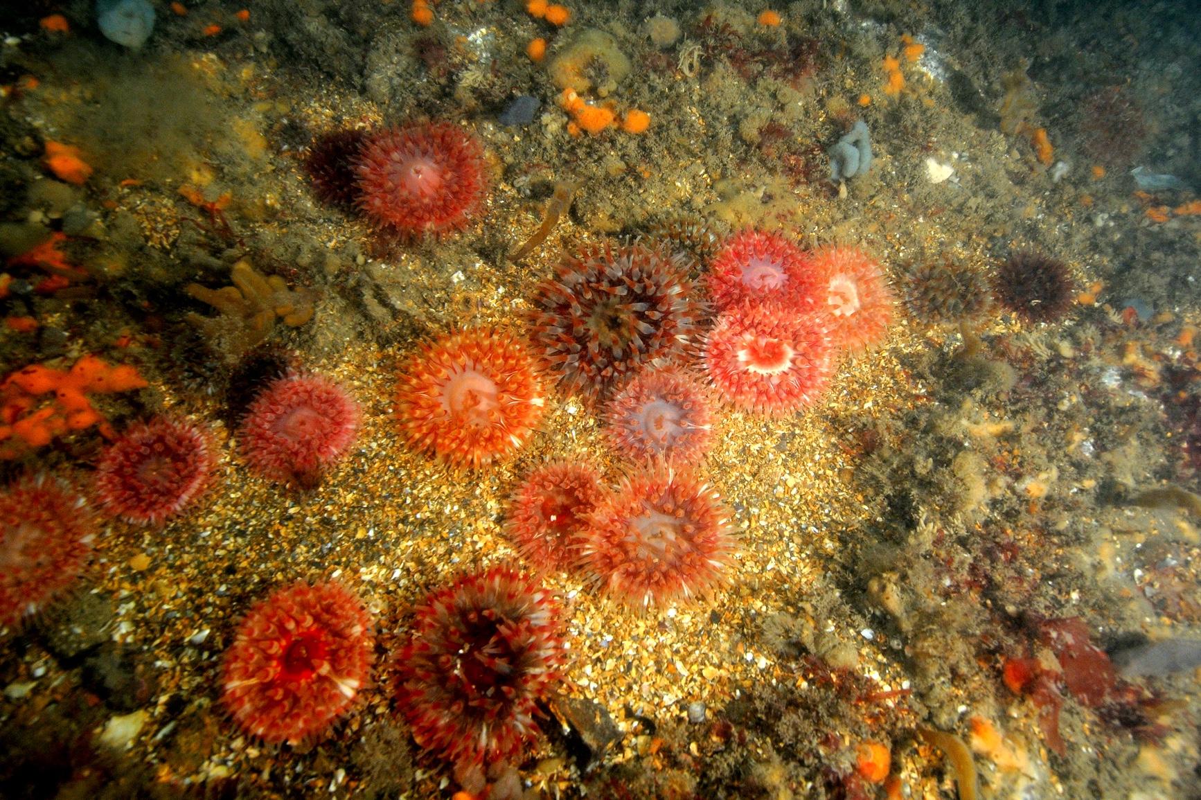
The Westermost Rough site supports a high yielding shellfish industry and populations of several sea bird species. A healthy benthic community is therefore important to sustain both biota and the ecological balance of the site. This report aims to provide an assessment of the benthic habitats and associated assemblages within and adjacent to the areas of potential impact resulting from the construction and of the WMR OWF. It also provides a comparison with previous data collected at the development site during pre-construction surveys. This survey aims to fulfil conditions within the WMR OWF Marine Licence (L/2011/00305) as part of the project Environmental Monitoring Programme (EMP).
 Series
2014, Jon Ford, Westermost Rough, Phase Bird Quarterly Survey Reports
These quarterly reports present the initial results of the construction phase bird monitoring programme for the Westermost Rough Offshore Wind Farm. The surveys reported here cover the monitoring work carried out between March and August 2014. The purpose of these reports is to document the surveys that have been undertaken during this period, the survey routes covered and present preliminary estimates of the bird populations present.
 Series
2014, Westermost Rough, Subsea Noise Monitoring During Foundation Installation
The report in this series presents a summary of the results obtained during underwater noise monitoring of piling activities at the Westermost Rough Offshore Wind Farm. The aim of the surveys was to monitor the underwater noise radiated from marine pile-driving during the installation of the monopile foundations during the construction phase of the WMR. The measurements were conducted during February and March 2014 and the data analysis during March 2014.
 Series
2014, HR Wallingford, Westermost Rough, Drill Cuttings Assessment for the Array
The purpose of this study is to inform a variation application by Westermost Rough Ltd. for the drill arisings disposal strategy (Marine Licence LA/2013/00309). The reason for the variation is that Westermost Rough Ltd. proposes that whilst the project does not expect to drill on more than a maximum of five foundation locations during installation works for the Westermost Offshore Wind Farm, the project requires flexibility to drill any foundation should it be required as a contingency. The previous study (and this one) assumed all of the monopile would be drilled (rather than sections that cannot be driven through) and so is worst case. This study assumes surface release (so modelling is necessary) unlike the last one which released near bed and so could use the monitoring results of near bed release at Lynn and Inner Dowsing wind farm. The report within this series provides an updated assessment of potential physical impact of drill arisings for the five already assessed and the other 30 foundations in the offshore wind farm. The report provides an assessment for the complete array of foundations. The desk based methodology in HR Wallingford (2013) has been combined with results from site specific numerical modelling of plume dispersion and deposition (Appendix A). The results are used to evaluate the potential physical impact of drill arisings on the Annex I stony reef habitat found within the Westermost Rough Offshore Wind Farm.
 Series
2013, MMT, Westermost Rough, Boulder Removal Campaign Out-Survey
MMT was contracted by DONG to perform a geophysical out-survey in the planned offshore wind farm Westermost Rough outside the Yorkshire coast, England. The Westermost Rough wind farm site is located approximately 8 km east of Yorkshire and the site is 5710 by 5710 m (approximately 35 km2). A previous survey by MMT (in-survey) has identified a number of boulders from MBES and SSS data, and 2796 of these boulders were selected by DONG to be removed by PMR. This MMT survey serves as an out-survey, with purpose to confirm that the agreed boulders has been removed from the site, and to identify remaining targets for removal. The survey comprises acquisition of MBES and SSS data for confirmation of removal of boulders, and identification of any remaining boulders.