

2012-2014, Centrica, Zone 9 - Celtic Array, LIDAR Windcube data
Summary
Data & downloads
Datasets
Related Pages
 Series
2014, Centrica and DONG, Zone 9 - Celtic Array, Stage 2 Preliminary Environmental Information
This document is the Preliminary Environmental Information (PEI) for the second stage of consultation on the RWF Offshore Development. The first consultation (Stage 1) took place between 29 October and 20 December 2012. Stage 1 PEI set out the initial proposal and described the potential environmental effects associated with it. All responses received during Stage 1 consultation have been considered in the Stage 2 proposal. The primary purpose of the Stage 2 PEI is to provide sufficient information to inform consultation prior to the production of the final Offshore Environmental Statement (ES), and gain feedback on the proposal. It seeks to inform technical consultees about the proposed RWF and sets out a more detailed project description. It also includes an assessment of the potential environmental effects of the Offshore Development application The report is split into 3 volumes : Volume 1 – Main Technical Report; Volume 2 – Technical Appendices and Volume 3 – Seascape, Landscape and Visual Amenity Figures Associated Document : SE-D-EV-001-0002-000000-001 ; SE-D-EV-001-0002-000000-002 ; SE-D-EV-001-0002-000000-003
 Series
2014, Centrica, Zone 9 - Celtic Array, Stage 2 Rhiannon Community Consultation
Celtic Array Limited (Celtic Array) is proposing to develop an offshore wind farm, called Rhiannon Wind Farm (RWF) in the Irish Sea which is anticipated to have a generating capacity of up to 2.2GW and this comprise both Offshore and Onshore Developments. This Community Consultation Document summarises the Offshore Development for the proposed Rhiannon Wind Farm in the Irish Sea and sets out a summary of the Stage 2 Preliminary Environmental Information (PEI) for offshore aspects of the scheme. It is intended to support the second stage of statutory consultation (following the first stage of consultation that took place in winter 2012) for the offshore aspects of the scheme relevant to the proposed application for a Development Consent Order (DCO) which will be made under the provisions of the Planning Act 2008. It is designed to provide you with information on the details of the proposal, the consenting process and a summary of the Stage 2 PEI. This series comprises of the Stage 2 Community Consultation Document and in English and in Welsh and also the Interim Consultation Report (March 2014). The Interim Consultation Report (the Report) was prepared on a voluntary basis to provide an update of consultation activities being carried out by Celtic Array in preparation for its application to the Secretary of State for Energy and Climate Change (Secretary of State) under the Planning Act 2008.
Series2014, Wessex Archaeology, Zone 9 - Celtic Array, Stage 3 Palaeoenvironmental Assessment of Borehole Samples
Wessex Archaeology (WA) was commissioned by Celtic Array Ltd. to undertake Stage 3 palaeoenvironmental assessment of borehole samples. The borehole samples come from 4 boreholes: BH23, BH30, BH32a and BH36a_G which were taken as part of a geotechnical survey for the proposed Rhiannon Offshore Wind Farm. The 4 boreholes had been previously archaeologically assessed and geoarchaeologically recorded the results of which have been outlined in the report. A total of 16 samples from boreholes BH23, BH30, BH32a and BH36a_G were assessed for palaeoenvironmental remains including plants, molluscs, foraminifera, ostracods, pollen, diatoms and dinoflagellates. No plants or diatoms were recorded within the samples. Molluscs, foraminifera, ostracods, pollen and dinoflagellates were recovered in varying but generally very sparse quantities. Due to the paucity of suitable organic remains within the sediments it was not possible to obtain suitable material for radiocarbon dating, which had been originally proposed. The results of the Stage 3 palaeoenvironmental assessment have been integrated with reference the previous geoarchaeological work and that of the British Geological Survey (BGS). Due to the lack of palaeoenvironmental remains and the high degree of reworking noted in some of the samples further Stage 4 analysis of the sampled sediments is not recommended. Available dataset : Reports in pdf and GIS data in shapefile format.
Series2014, Regeneris Consulting, Zone 9 - Celtic Array, Offshore Socio Economic Study
This study forms chapter 19 of the Stage 2 Preliminary Environmental Information (Stage 2 PEI) of the Rhiannon Offshore Wind Farm, which is part of the Environmental Impact Assessment (EIA). The study was carried out by Regeneris and it describes the existing environment with regard to socio-economics and assesses the potential impacts of the Offshore Development area of the proposed Rhiannon Wind Farm (RWF). This study is closely linked to Chapter 13 Commercial Fisheries; Chapter 14 Shipping and Navigation; and Chapter 16 Seascape, Landscape and Visual Amenity of the Stage 2 Preliminary Environmental Information (Stage 2 PEI) and should be read in conjunction with Appendix 19.1 Environmental Assessment; Appendix 19.2 Local Area Profiles; and Appendix 19.3 Tourism Literature Review. Activities covered by the assessment are : All project design and planning relating to offshore infrastructure; Manufacture of turbines, foundations, cables and offshore substations; Installation of turbines, foundations and cables (cables extend to the cable landfall sites up to Mean High Water Springs); All operations and maintenance activity relating to turbines, foundations and cables; All decommissioning of offshore works
 Series
2014, Anatec, Zone 9 Celtic Array, Shipping and Navigation
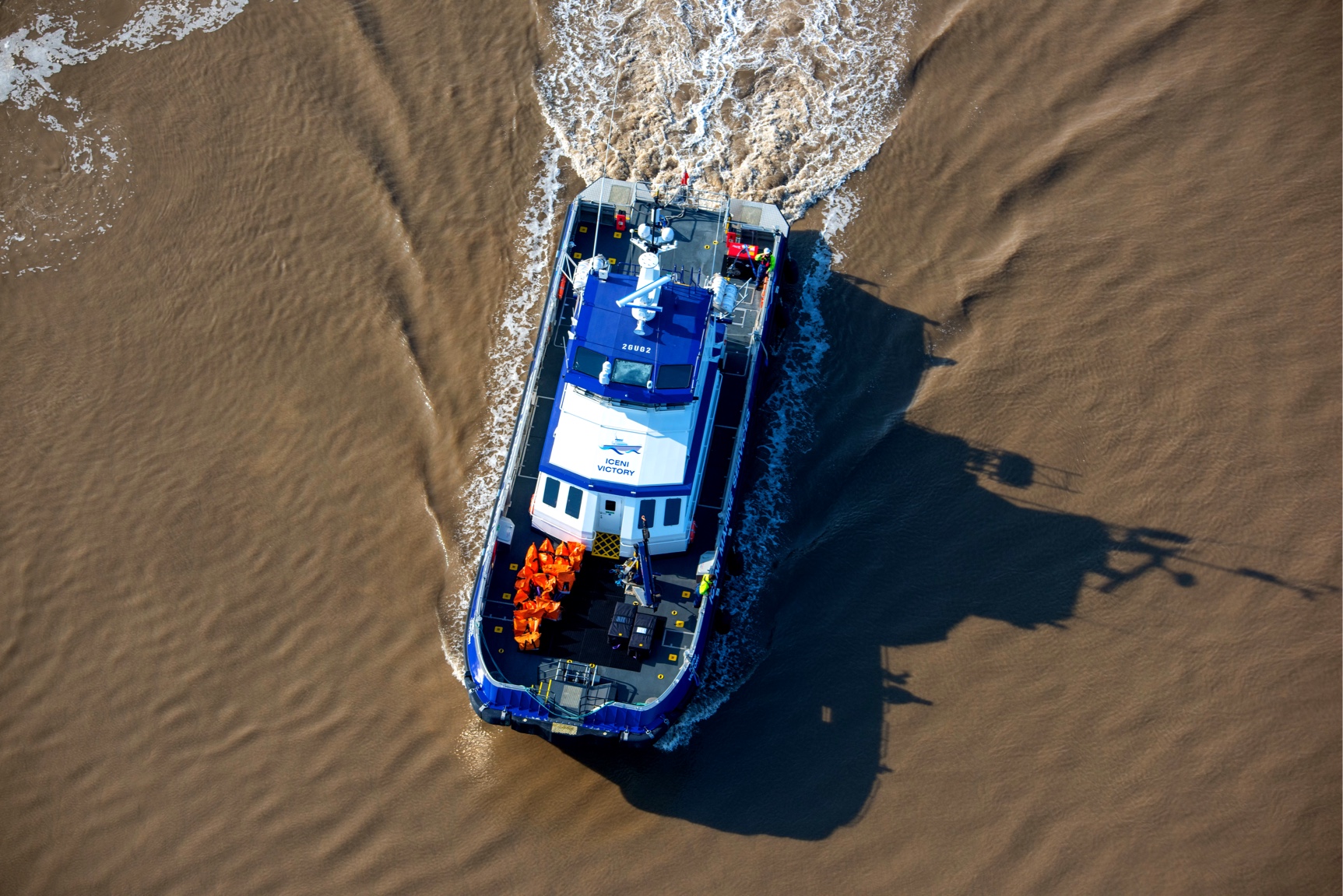
This study forms Chapter 14 of the Stage 2 Preliminary Environmental Information (Stage 2 PEI) of the Rhiannon Offshore Wind Farm, which is part of the Environmental Impact Assessment (EIA). The study was carried out by Anatec Limited and it describes the existing environment with regard to shipping and navigation and assesses the potential impacts of the Offshore Development area of the proposed Rhiannon Wind Farm (RWF).
 Series
2013-2014, Subacoustech, Zone 9 - Celtic Array, Noise Assessment
Subacoustech Environmental Ltd carried out a detailed noise assessment for the proposed Rhiannon Wind Farm (RWF) on behalf of Centrica. This assessment forms Chapter 9 and 11 of the Stage 2 Preliminary Environmental Information (Stage 2 PEI) of the Rhiannon Offshore Wind Farm, which is part of the Environmental Impact Assessment (EIA). Analysis and modelling of underwater noise at various stages of the life-cycle of the developments were considered. For the underwater environment the source of noise relevant to construction and operational life were considered. A combination of bespoke software models and database information – gathered from monitoring at many previous wind farm constructions were used to produce these results. The results were presented using various metrics, capturing both the behavioural and the possible injurious nature of sounds. The results were also presented for the relevant range of fish and marine mammals. From a behavioural perspective each species has been considered separately since the noise will have a different impact on species due to the differing perceptions of noise caused by their differing hearing capabilities. Ranges and areas of influence were given without relationship to actual population distributions. Underwater noise components for the four aspects of the lifecycle of the build: Baseline, pre-construction; Construction phase; and Operational phase were considered. The cumulative effects of noise in terms of how multiple potential sources of noise could be integrated in terms of their environmental impact were considered where possible, as well as the cumulative effects of the influence of nearby wind farms. Also decommissioning was considered briefly, although a further impact assessment will most likely be required nearer the time.
Series2013, Wessex Archaeology, Zone 9 - Celtic Array, Stage 2 Geoarchaeological Recording of Borehole Samples
Centrica Energy Renewable Investments Limited (CERI) now Celtic Array commissioned Wessex Archaeology to undertake to undertake geoarchaeological recording of borehole samples. The borehole samples come from 43 boreholes taken as part of a geotechnical survey of the proposed Rhiannon offshore wind farm. Of the 43 boreholes acquired and assessed in Stage 1 (Wessex Archaeology , Celtic Array Ref SE-D-CE-073-0000-000000-011), 13 were recommended to be taken on to Stage 2 recording and sampling, all of which have been outlined in this report. A total of 167 samples from Boreholes 02a, 03, 08a, 23, 24, 30, 32a, 33, 34 (and 34b_G), 35, 36 (and 36a_G), 37 and 42, were geoarchaeologically recorded during June and July 2013 at Wessex Archaeology. The results of the Stage 2 geoarchaeological recording have been integrated with the geophysical interpretation of the area with the following sedimentary And a Stage 3 palaeoenvironmental assessment and scientific dating of Units 2, 5a, 5b, 6, 7 and 8 is warranted in order to better understand the chronology, depositional environments and archaeological potential of the sediments. Corresponding Centrica Document No: SE-D-EV-132-0117-501051-002 Available dataset : Reports in pdf formats, GIS data in shapefile and geodatabase format,
 Series
2013, Reynolds International, Zone 9 - Celtic Array, South East Celtic Array Stage 1 Ground Model
Series Description: A re-interpretation of single-channel seismic data along a sub-set of survey profiles across the SE part of Celtic Array Wind Farm in the Irish Sea. This was followed by the SE Stage 2 Ground Model (report number SE-D-EN-078-0117-501038-023) Centrica Project: Round 3 Irish Sea - Zone 9 Offshore Wind Farm Development; Project Phase: Consenting; Survey Title: South East Celtic Array Stage 1 Ground Model Surveyor: Reynolds International Limited; Survey Date: 2013 Corresponding Centrica Document No: SE-D-EN-078-0000-501038-004 and SE-D-EN-078-0000-501038-004-Att1 Available Datasets and supporting documentation: 1.Log Analysis (.dat, .xls, .csv) ; 2.Maps (.pdf); 3. Map Packages (.mpk); 4.Type sections (.pdf, .png); 5. Images(.pdf, jpg) ; 6. Survey Documentation: Borehole reports, Reports, (.pdf)
 Series
2013, Halcrow Group, Zone 9 - Celtic Array, Horizontal Direction Drill Feasibility Study
Celtic Array Ltd previously contracted Halcrow Group Ltd (Halcrow) in October 2012 to undertake a horizontal direction drill- HDD Feasibility Study to assist with the development of the proposed offshore Rhiannon wind farm in the ISZ – Irish Sea Zone. In January 2013, Celtic Array requested Halcrow to undertake a review of the preliminary geophysical survey and drawings which were produced by EGS (International) Ltd in Autumn/Winter 2012 during the marine geophysical survey of the proposed Rhiaanon offshore windfarm on behalf of Celtic Array. Halcrow was to review the relevance of this Geophysical survey drawings to the Bull Bay site (7a) and Site 12 landfall areas. Halcrow Group Ltd prepared this Technical Note in accordance with the instructions of Celtic Array Ltd for their sole and specific use. Any other persons who use any information contained herein do so at their own risk. Available dataset: GIS in Shapefile formats ; AutoCAD data in dwg format (linked to R3 2012 Halcrow HDD Feasibility Study), reports and drawings in pdf formats.
 Series
2013, ABPmer, Zone 9 - Celtic Array, Physical Processes Assessment
This study forms Chapter 7 of the Stage 2 Preliminary Environmental Information (Stage 2 PEI) of the Rhiannon Offshore Wind Farm, which is part of the Environmental Impact Assessment (EIA). The study was carried out by ABPmer and it describes existing environment with regard to Physical Processes and assesses the potential impacts of the Offshore Development area of the proposed Rhiannon Wind Farm (RWF). The study characterises the marine physical environment which is defined here as the water quality, hydrodynamic, geomorphological and sedimentary regime that operates within the Wind Farm Site (the Site) and across the surrounding study area. This is within the eastern part of the Irish Sea and it assesses the potential effects of the Offshore Development on physical process and related receptors. The work presented here builds upon the physical process studies carried out to support the Zonal Assessment Process (ZAP) that was completed in 2012 (Celtic Array 2012a). A summary of the ZAP physical process assessments is presented in Appendix 7.1 This study is closely linked to Chapter 6 Geology and Sediment; Chapter 8 Nature conservation; Chapter 9 Benthic ecology and Chapter 10 Fish ecology of the Stage 2 Preliminary Environmental Information (Stage 2 PEI) and should be read in conjunction with Appendix 7.1 ZAP Physical Processes Assessment; Appendix 7.2 Model Calibration; Appendix 7.3 Water and Sediment Quality; Appendix 7.4 Initial Metric Calculations; and Appendix 7.5 Scour Assessment.
Series2013, Osprey, Zone 9 Celtic Array, Aviation and Radar
This study forms Chapter 15 of the Stage 2 Preliminary Environmental Information (Stage 2 PEI) of the Rhiannon Offshore Wind Farm, which is part of the Environmental Impact Assessment (EIA). The study was carried out by Osprey Consulting Services Ltd and it describes the existing environment with regard to aviation and radar and assesses the potential impacts of the Offshore Development area of the proposed Rhiannon Wind Farm (RWF). This study is closely linked to Chapter 14 Shipping and Navigation, due to the consideration of helicopters in emergency response. The study area includes consideration of the aerodrome and ATC PSR at RAF Valley and BAE Warton. Whilst outside of the 30km consultation zone as per the CAP764 guidance, radar and ATC services are known to be provided beyond this zone. RAF Valley provides the Lower Airspace Radar Service out to a range of 40nm from the aerodrome and BAE Warton claims to provide LARS out to 40nm and other services out to a range of 120nm; the RWF Site boundary is between 40nm and 60nm from BAE Warton. Also ATC en-route radars operated by NATS at Lowther Hill (Scotland) and St Annes (near Blackpool), and Isle of Man Airport which operates an ATC PSR. Whilst this airport is outside the CAP764 30km consultation zone, potential impacts were identified during the ZAP and will be studied in the context of the RWF Site and also in the cumulative assessment with reference to the future development of the north east area of the ISZ.
 Series
2013, University of Liverpool and Bangor University, Zone 9 - Celtic Array, Glacial land systems in the Irish Sea Basin
Dataset Description: Glacial land systems in the Irish Sea Basin: approaching a sediment-landform predictive model for the sea floor - Geological appraisal of swath bathymetry and seismo-stratigraphic data in the SE region of the R3 zone - Liverpool Bay; Centrica Project: Round 3 Irish Sea - Zone 9 Offshore Wind Farm Development; Project Phase: Consenting; Dataset produced Out By: Liverpool/Bangor University ; Corresponding Centrica Document Title: Land system model SE Lease Zone Available Datasets and supporting documentation: 1. GIS data (.shp, mxd, Raster) 2.Drawings (.pdf, .tif) 3. Documents (.pdf)