

2013, HR Wallingford, Dudgeon, Scour Development for WTG Foundations
Summary
Data & downloads
Reports
Related Pages
 Series
2022, XOCEAN, Dudgeon, Asset Integrity Survey
During June 2022 XOCEAN were asked by Reach Subsea AS to perform a full site survey on behalf of Equinor within the Dudgeon OWF. Data was acquired over the full area of the Dudgeon OWF and one export cable route. A single survey campaign was conducted from July 31st to October 16th 2022. The survey objective was to use a multibeam echosounder to collect suitable data coverage and density to identify any items larger than 0.5 m. - 1 m Digital Terrain Model (DTM). - Achieve a sounding density of 5 hits per 1 m cell. - Feature picking of objects greater than 0.5 metres.
Series2018, MMT, Dudgeon Offshore Wind Farm, Geophysical and Environmental Survey
Equinor have awarded MMT a geophysical and environmental survey of the Dudgeon Offshore Wind Farm (DOWF). The wind farm has a total of 67 Siemens 6.0 MW Wind Turbine Generators and one Offshore Substation (OSS) approximately 32 km off the North Norfolk coast in water depths ranging from 17 m to 24 m. The aim of the geophysical survey was to acquire accurate high-resolution bathymetry data along the export cable route and throughout the OWF area, identifying any areas of concern including exposed cables. For information on the cable survey part of this project, see Marine Survey Report: 102952-EQUMMT- SUR-REP-CABLESUR. For information of the sandwave migration part of this project, see Marine Survey Report: 102952-EQU-MMT-SUR-REP-SANDWAVE. Seabed features and contacts are detailed in the Marine Survey Report 102952-EQU-MMT-SUR-REPSIDESCAN.
 Series
2016, Subacoustech, Dudgeon, Comparison of measured and modelled noise levels during installation of monopiles
Construction began at the Dudgeon Offshore Wind Farm with the installation of monopile foundations during March 2016. The noise levels from impact piling operations were measured and reported by Gardline Environmental Ltd (2016). Measurements were taken at two locations from the piling operations at ranges of 750 m and 4 km using Autonomous Recording Units (ARU). Transmission Loss data was calculated using the RAMGeo acoustic model in order to calculate source levels and impact ranges, which were then compared against predictive modelling undertaken by Subacoustech Environmental before construction. Subacoustech Environmental have been asked to comment on how the previous modelling and the measurement data compare. This technical note presents a comparison between the previous modelling and measured data as well as providing information on extrapolating the results for a worst case piling hammer blow energy of 3000 kJ. At the time of writing, Subacoustech Environmental have not had visibility of the final measurement report and as such this report is not intended to provide a validation of the measurements or measurement methodology.
 Series
2016, Gardline, Dudgeon, Underwater Noise Monitoring During Installation of Monopiles
Gardline Environmental Ltd. (GEL) provided underwater noise monitoring surveys during the construction phase of the Dudgeon Offshore Wind Farm for Dudgeon Offshore Wind Ltd. The aim of the underwater noise monitoring survey was to validate predictions developed within the Environmental Statement (ES) (Dudgeon Offshore Wind Farm, 2009), Supplementary Environmental Information (SEI) (Dudgeon Offshore Wind Farm, 2013), and finalised in the Marine Mammal Mitigation Plan (MMMP) (Statoil, 2015) with regard to the magnitude of construction noise and to assess ADD sound from the piling operations. The measurements and data analysis were completed during March and April 2016. The report in this series describes the results from the underwater noise monitoring surveys during the installation of the first eight monopile foundations. Also included within the report is a description of the methodology and data analysis performed.
 Series
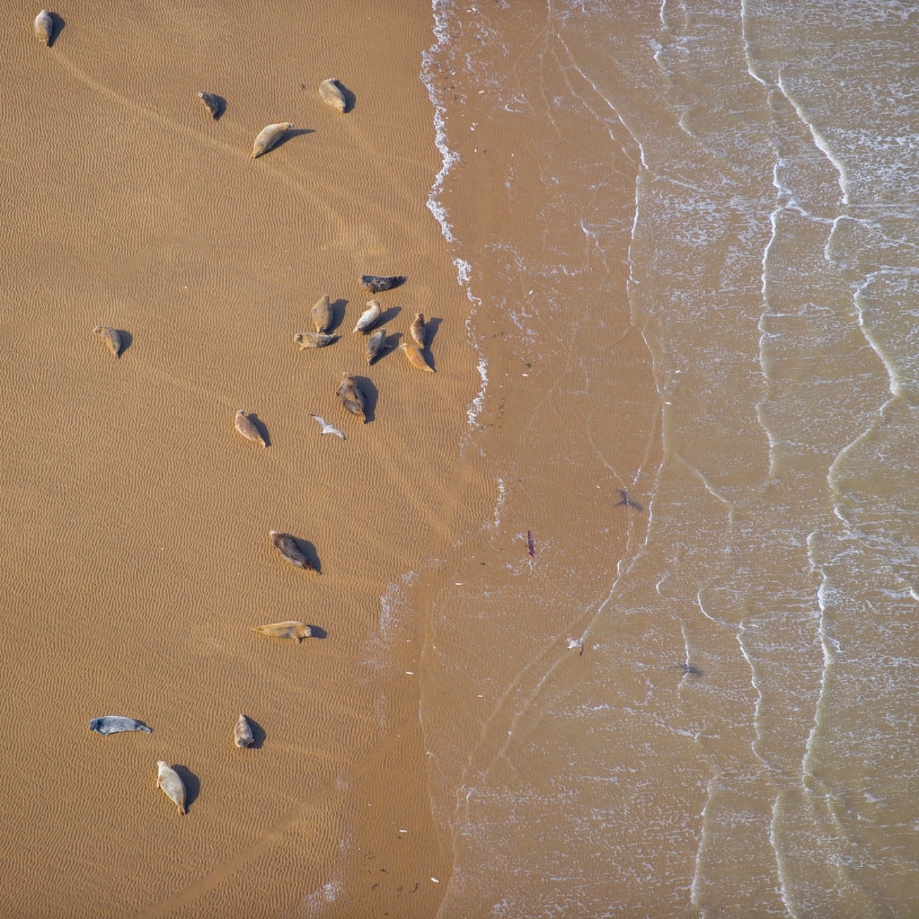
2015-2016, SMRU Consulting, Dudgeon, Report on the distribution and abundance of harbour seals (Phoca vitulina) during the 2015 and 2016 breeding seasons in The Wash
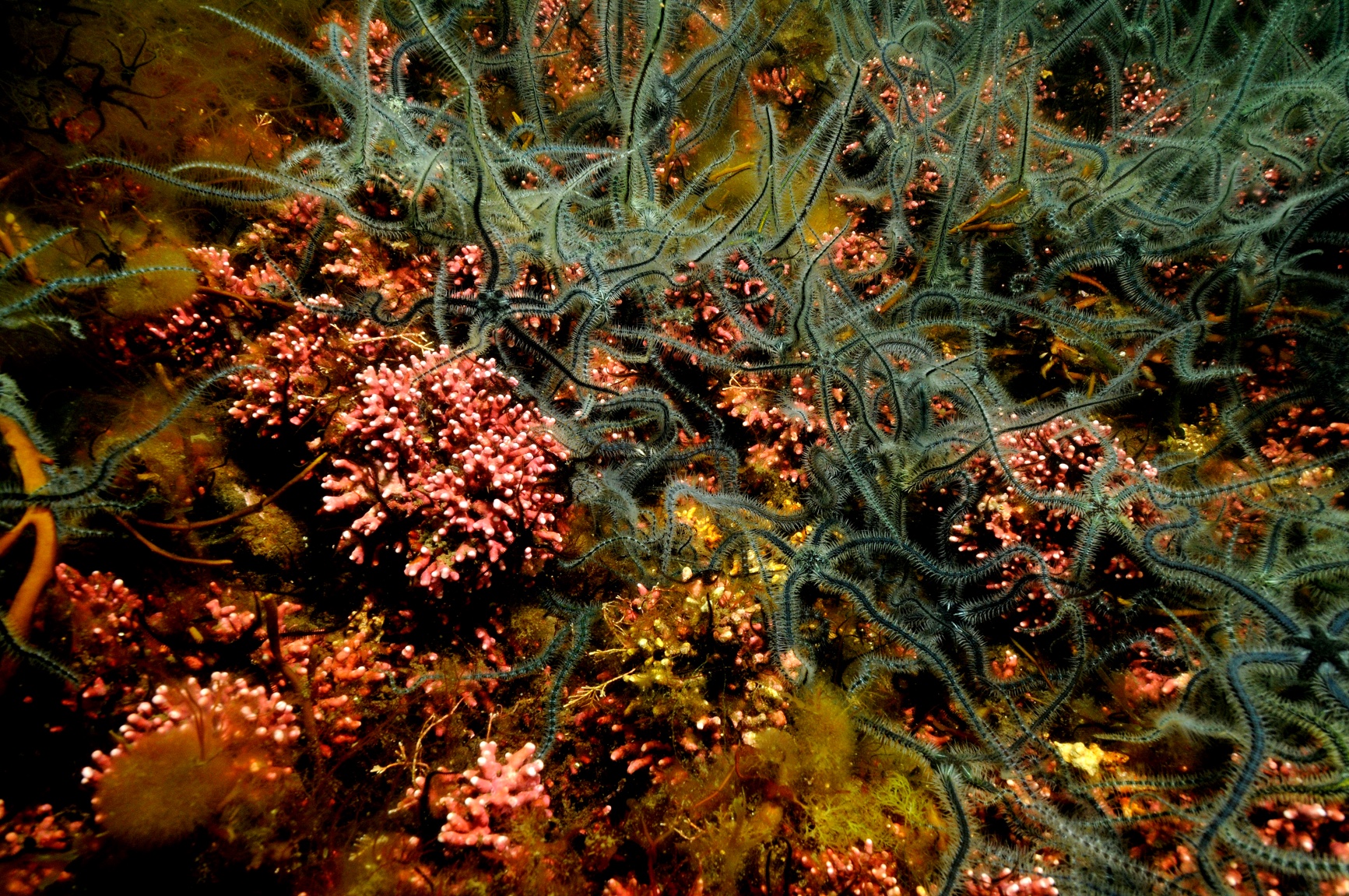
This report presents the results of a series of aerial surveys of the harbour seal population along the English east coast between Donna Nook in Lincolnshire and Scroby Sands off the Suffolk coast during the breeding seasons from 16th June to 17th July 2015 and 19th June to 16th July 2016. - Five surveys were completed on the 16th, 21st and 27th June and 3rd and 17th July 2015. - Five surveys were completed on the 19th, 24th June and 2nd, 8th and 16th July 2016. - As usual, flights were restricted to weekends because of RAF range activity. Poor weather conditions on the weekend of 10th July 2015 prevented flying and delayed the final flight to the 17th July 2015. This had no negative effects on the results. - The highest count obtained in 2015 was 1351 on 27th June and in 2016 the highest count was 1580 on 2nd July. Examination of the series of counts suggests that this is close to the actual maximum number of pups for the season. Examination of the five survey counts in each year suggests that these are close to the actual maximum number of pups in each year. - The 2015 count was substantially lower (22%) than the 2014 equivalent count, but the 2016 peak count was 17% higher than in 2015. These wide fluctuations are not unusual in the long term time series. - Despite the apparently wide inter-annual variation, the pup production has increased at around 7.4% p.a. since surveys began in 2001. - The distribution of pup counts within The Wash has changed with more pups in the sheltered South East corner, and more along the banks of the main river channels. These changes appear to have happened between 2001 and 2010. - Pup productivity has apparently increased relative to the independent estimates of the total population size
 Series
2014, Fugro EMU, Dudgeon, Baseline Ecology Study
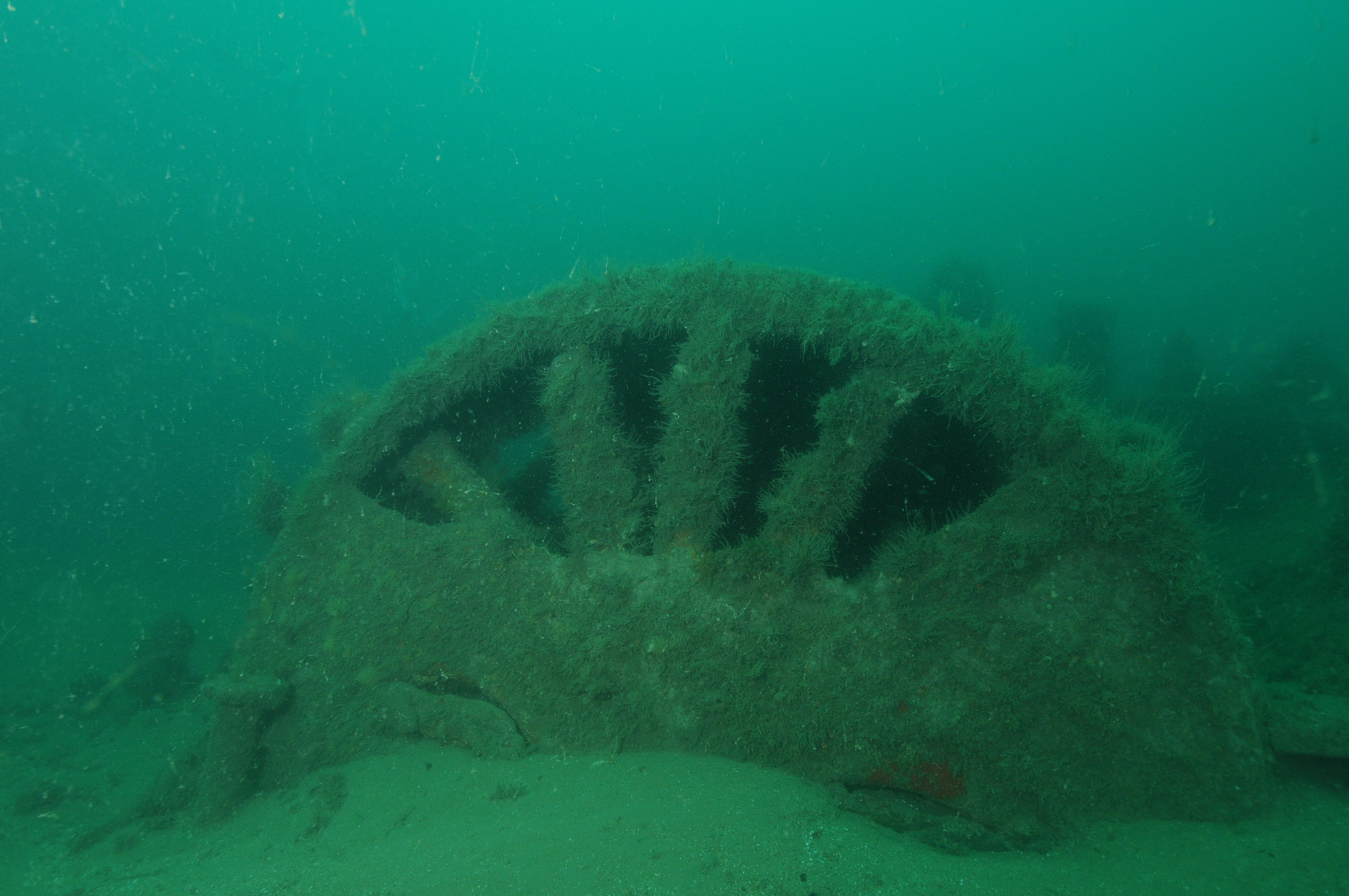
DOW is located 32 km off the North Norfolk coast, in water depths of between 18 m and 25 m. The site will have a capacity of 402 MW (Mega Watts) and comprise of 67 wind turbine generators. The export cables will be approximately 38 km long, with the cable landfall at Weybourne Hope. As part of the Environmental Statement (ES) required for the application process for permission to develop DOW, benthic ecology surveys of the proposed development area were carried out in 2008, with further habitat mapping, based on sidescan data and video sampling, undertaken in 2013. The current study was required in order to acquire more targeted pre-construction data and build on the information collected during the 2008 and 2013 surveys. This in turn will provide robust baseline formation on the physical and biological characteristics of the subtidal benthic habitats and associated faunal communities, against which potential impacts arising from the construction and operation of the wind farm can be assessed. The pre-construction survey comprised of 0.1 m2 Hamon grab sampling for infaunal invertebrate and sediment particle size distribution analyses. Epibenthic survey trawls were also undertaken, by means of 2 m Beam Trawls for semi-quantitative assessment of epibenthos and fish and shellfish species. A targeted drop-down camera survey was undertaken to ground truth sidescan sonar data in relation to potential presence of Sabellaria spinulosa reefs and to further assess benthic habitats as identified by the geophysical survey. Sidescan sonar and geophysical data were acquired during previous surveys of the area, undertaken by Fugro EMU on board the survey vessel, MV Ocean Dawn.
 Series
2014, Wessex Archaeology, Dudgeon, Geophysical Assessment
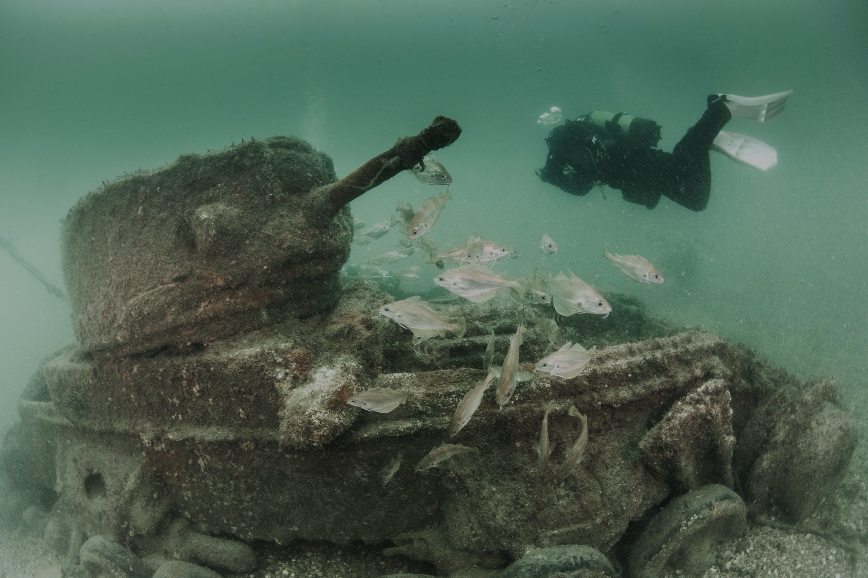
Wessex Archaeology was commissioned by Royal Haskoning DHV on behalf of Dudgeon Offshore Wind Limited (DOW) to conduct an archaeological assessment of geophysical data obtained over the site of the Dudgeon Offshore Wind Farm and its associated export cable route. An archaeological interpretation and assessment of sidescan sonar, magnetometer and multibeam bathymetry data was undertaken. For the purpose of reporting, the study area was separated into the Offshore Wind Farm and the export Cable Route. The Dudgeon Offshore Wind Farm site is situated approximately 32km offshore of Cromer on the north Norfolk coast. The Offshore Wind Farm comprises 67 wind turbine locations and their associated Inter-array cables. A 500m corridor for the Inter-array Cables and a 50m radius buffer zone for each of the wind turbine locations were assessed. The export cable route will make landfall as Weybourne Hope, approximately 5km west of Sheringham; with a 500m corridor being assessed.
 Series
2014, Wessex Archaeology, Dudgeon, Stages 1 to 3 Geoarchaeological and Palaeoenvironmental Assessment
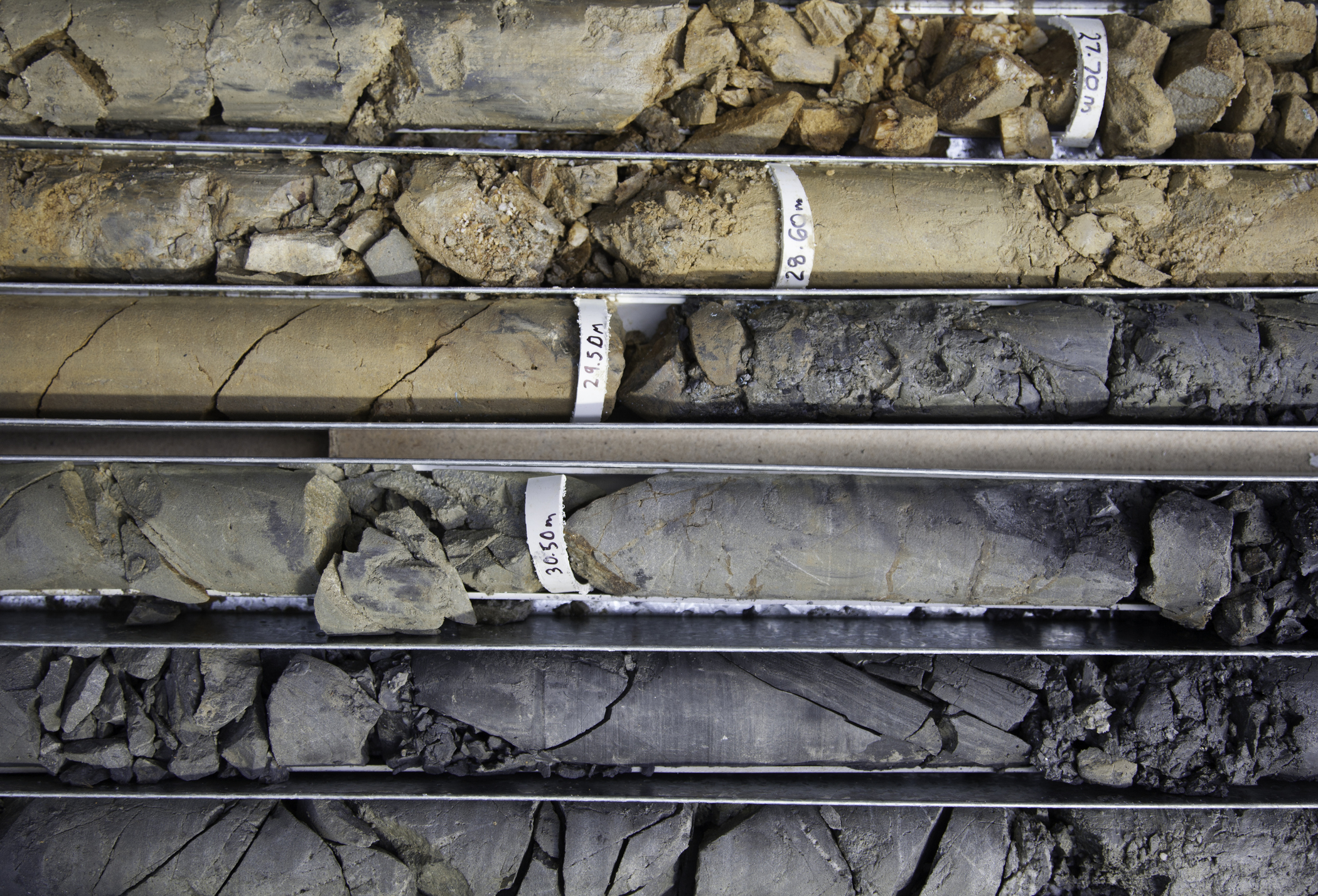
Wessex Archaeology was commissioned by Royal Haskoning DHV to undertake Stage 1 to 3 geoarchaeological and palaeoenvironmental assessment of borehole samples from the site of the proposed Dudgeon Offshore Windfarm. The Stage 1 work comprised the assessment of 27 borehole logs and 32 CPT (Cone Penetrometer Test) logs. The Stage 2 work comprised the geoarchaeological recording and subsampling of 63 samples from 6 boreholes (BH06, BH13, BH15, BH19A, BH21 and BH25). The following geological formations were interpreted from the Stage 1 and 2 work: • Chalk Bedrock • Swarte Bank Formation • Egmond Ground Formation • Bolders Bank Formation • Holocene terrestrial sediments • Seabed Sediment The Pleistocene sediments including the Swarte Bank, Egmond Ground and Bolders Bank formation were identified as glacial and shallow marine deposits thought to have been deposited during the Lower and Middle Palaeolithic archaeological periods. The Holocene terrestrial sediments were subjected to Stage 3 palaeoenvironmental assessment with two boreholes BH06 and BH21 providing the focus for study. Assessment for pollen, diatoms, foraminifera, ostracods, plants and molluscs was undertaken in conjunction with radiocarbon dating revealing interesting freshwater and estuarine environments dating to the Mesolithic archaeological period. In addition, the dating suggests that sediments within borehole BH06 might also relate to the Storegga slide tsunami which is thought to have affected Mesolithic communities in the North Sea area around 8100 years ago. Stage 4 analysis of pollen, foraminifera, ostracods, plants and molluscs and further radiocarbon dating is recommended in particular to better understand the interesting sediments within borehole BH06.
 Series
2014-2015, ChalkRock, Dudgeon, Geotechnical Reviews
This series consists of two geotechnical reviews undertaken by ChalkRock Ltd. The first is a review of the Chalk borehole cores. As part of the Ground Investigation for the Dudgeon OWF, Rory Mortimore of ChalkRock Ltd was instructed to log the Chalk borehole cores for the Statoil Dudgeon Offshore Windfarm. An agreed scope of works included: - Check log the cores at the offices of GEO, Copenhagen - Compare the results with the first phase boreholes - Provide a stratigraphical framework for the interpretation of the marine geophysical survey - Provide a stratigraphical and lithological framework for the distribution of physical properties (Intact Dry Density (IDD)) across the wind farm site. The second review in this series is a review of data acquired and comparison with the Sheringham Shoal Offshore Windfarm. An agreed scope of works included: - Review the data acquired - Compare Dudgeon OWF to Sheringham Shoal data - Comment on similarity of Dudgeon OWF to Sheringham Shoal and implications of any variation - Comment on Engineering implications of data collected from Dudgeon for monopile foundations. Two reports resulting from the reviews are provided within this series.
 Series
2014, Fugro Geoconsulting, Dudgeon, Geotechnical Site Investigation
Statoil Petroleum AS (Statoil) and Statkraft are currently developing the Dudgeon Offshore Wind Farm (OWF) site in Block 48 of the UK Sector, North Sea. The proposed development is located approximately 45 km north east of Cromer in North Norfolk, UK. Statoil requested that Fugro GeoConsulting Limited (Fugro) perform a site investigation to provide soils information to assist with the proposed development of the Dudgeon OWF site. The fieldwork was performed in accordance with instructions received from Statoil. Combined sampling and cone penetration testing (CPT) boreholes were performed from the geotechnical drilling vessel MV Bucentaur from 24 March 2014 to 2 April 2014. A summary of work completed is shown in Table 1.1. Following completion of the fieldwork the soil samples were sent to the Danish Geotechnical Institute (GEO), who are contracted to perform the onshore laboratory testing and associated further reporting. The report within this series presents the following information: i. Description of the site investigation; ii. Description of methods employed for the drilling, in situ testing and sampling; iii. Results of in situ testing and field laboratory testing; iv. Information on recovered samples; v. Geotechnical logs and descriptions of the soil strata; vi. Brief details of the parties involved; vii. Positioning and water depth measurements; viii. Equipment data sheets and calibration certificates used during the offshore phase of the project.
Series2014, Wessex Archaeology, Dudgeon, Archaeological Monitoring and Mitigation
Wessex Archaeology (WA) has been commissioned by Royal HaskoningDHV to prepare a Written Scheme of Investigation (WSI) for the offshore elements of the Dudgeon Offshore Wind Farm (DOW) project. An archaeological assessment of geotechnical data from the Dudgeon Offshore Wind Farm area has been undertaken, including a Stage 1 to 3 Geoarchaeological and Palaeoenvironmental Assessment (Wessex Archaeology 2014a). Results of this assessment have been incorporated into this WSI. An archaeological assessment of 2013 geophysical data for the WTG layout, interarray cable study area and export cable survey area has also been undertaken (Wessex Archaeology 2014b). The geophysical data collected for this assessment are higher resolution than the data initially assessed, and therefore provide additional details about the archaeological resource.
Series2013, GEO and Thomson Unicomarine, Dudgeon, Geotechnical and Benthic Surveys
Dudgeon Offshore Wind Ltd. (DOW) contracted GEO to conduct a geotechnical site investigation including seabed deep Piezo-Cone Penetration Testing (CPTU) at the planned Offshore Wind Farm at Dudgeon, and shallow CPTU with vibrocoring along the cable route. GEO carried out a geotechnical soil investigation in October 2013. The analysis of 120 benthic video samples was then carried out by Thomson Unicomarine.