2015, EGS, Inner Dowsing - Lynn - Lincs, Turbine Clearance Survey

2015, EGS, Inner Dowsing - Lynn - Lincs, Turbine Clearance Survey

Powered by: TCE
Don't show this

What is a series page?

Download MEDIN file

Last series update:

May 2023

Collection date:

March 2015 - March 2015

The collection date represents the period of data collection or study duration. For example: '16/04/2015-05/05/2015'

Publication date:

May 2023

The publication date is the date the series was published on the Marine Data Exchange. For example: '23/04/2017'

Published by:

The Crown Estate

Summary

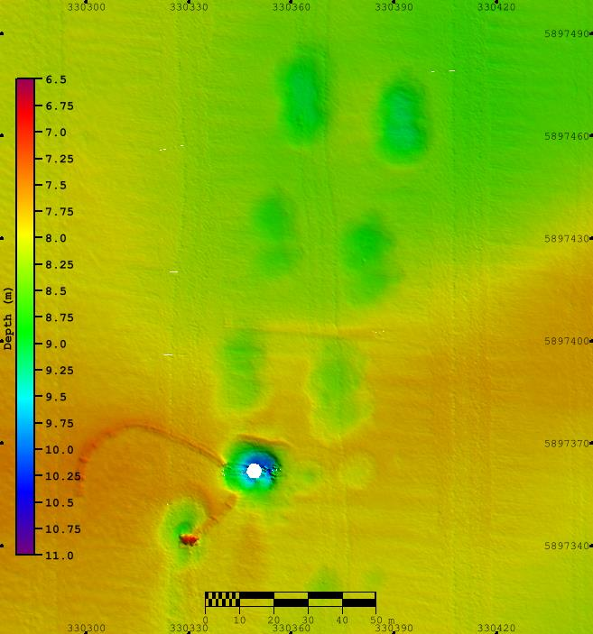
EGS (International) Ltd, on behalf of Centrica, undertook a Side-Scan Sonar (SSS) and Multibeam (MBES) clearance survey centered on the no cable zones (500m by 500m) around around WTGs LS28 (on the Lincs site) and WTGs ID16 and ID24 on the Inner Dowsing Site which is located in the southern North Sea, approximately 5km off the coast of Lincolnshire...

Categories:
Geophysical
Categories indicate the area of study or data type the series is associated with. For example, a survey carrying out grab sampling would have the category 'Benthic Ecology', while a desktop study exploring the impact of substation design on bird nesting would have the categories ' Birds, Engineering Design'
Available in this series:
Data Highlights
1
Datasets
2
Reports
1

Data Highlights


Explore the wealth of the data gathered in the 2015, EGS, Inner Dowsing - Lynn - Lincs, Turbine Clearance Survey


4

Lynn and Lincs Offshore Wind Farms, Turbine Clearance Survey